
NCI’s innovative satellite data imagery hub
The Copernicus Regional Data Hub is a world-leading program to share imagery from the European Sentinel satellites with the South-East Asian region. An agreement between the Australian Government (through Geoscience Australia) and the European Commission finalised in May 2016 is bringing all of the Sentinel images of our region to a data hub at NCI.
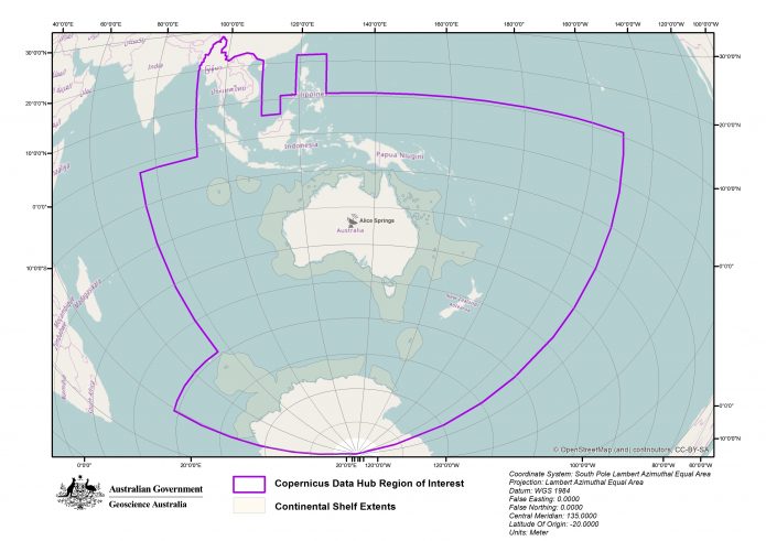
Covering countries from Myanmar to Samoa and much of the Antarctic Territories, the Hub provides up-to-date imagery for scientific, policy and land management uses impacting hundreds of millions of people. To transfer that imagery from its base in Germany to NCI, and then store it and present it to users in a powerful analysis environment brings together many elements of NCI’s advanced computing services.

The Copernicus Data Hub Area of Interest, covering Southeast Asia and the Pacific. Image courtesy of Geoscience Australia.
The key elements are international networking to quickly and effectively transfer the data, storage for the data once it is here, high-performance computing to process the data to make it useable and cloud computing to serve the data to Data Hub users.
NCI’s High-performance Data Team Leader overseeing the Copernicus Data Hub Dr Joseph Antony says “The level of expertise needed to bring the Data Hub to life means that NCI is uniquely placed to do this. No one has tried to transfer such large quantities of data over such a large distance before, so our expertise debugging the international data transfer networks is proving useful in bringing this project to fruition.”
All of the data in the Hub is stored in multiple backed-up rapid-access libraries, and it can all be viewed and analysed through NCI’s cloud computing platform, the Virtual Desktop Infrastructure (see Case Study 1). This has already led to important uses in Australia, such as recent work monitoring coral bleaching on the Great Barrier Reef and mapping floodwaters using the Sentinel satellites.
Dr Antony says “The satellites produce images at such high resolution that coral reefs and individual trees can be seen. The post-processing NCI partners and end users do to the data we receive turns it into usable images that many analysis applications can work on. We’re excited to facilitate all of the research that will come from this data.”
Enabling research for a wide variety of users is a key part of NCI’s mission. The Copernicus Regional Data Hub is laying the foundations for years of data-intensive science to take place. The data management infrastructure implemented by NCI to support the program continues to demonstrate the quality that NCI users have come to rely on.
To browse the current Copernicus data collections, go to www.copernicus.gov.au and access NCI’s THREDDS data server from there.
Original article posted on NCI, 17 Oct 2017 (link)