
Plan to divert water from Darling River to Toorale National Park floodplain causes anger
A $24 million deal made to help the Darling River flow again could now be “flipped” to allow the New South Wales Government to extract river water to spread on its own floodplain.
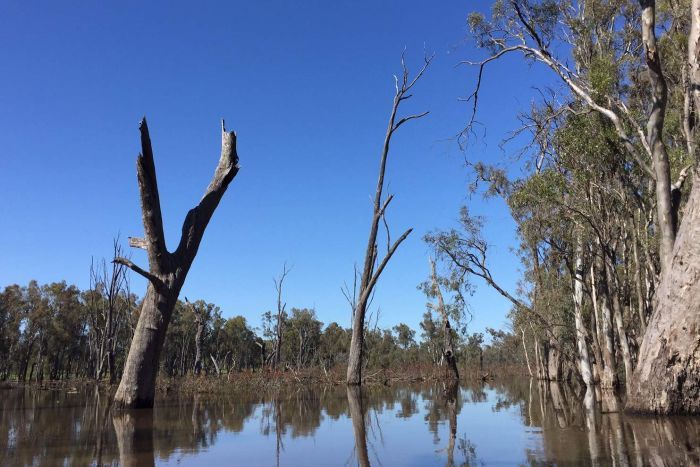
Locals downstream of Toorale National Park near Bourke say they are flabbergasted plans are being prepared to divert water from the Warrego River to the western floodplain, a diverse habitat for birds, fish and frogs.
Meanwhile, Member for Barwon Roy Butler has labelled the plan “illegal”.
“That water would make all the difference to a town further downstream, to having their weir pools replenished or having the holes in the river filled for fish habitat,” Mr Butler said.
The plans, which have been on public exhibition, would see the installation of automated regulator gates to allow the national park’s staff to control river flow.
Mr Butler estimated between two and five gigalitres of water could go to Toorale’s own floodplain each year.
This could be illegal, he said, because the government had no infrastructure in place to measure the water leaving the river system.
If any normal person put in place an illegal diversion on a river or a creek, they would be taken to court but here we have government putting in place an illegal diversion onto a flood plain,” Mr Butler said.
New plan is ‘backflip’ says MP
In 2008, the Australian and NSW Governments purchased Toorale Station for $24 million, as well as its water entitlements, amounting to 14 billion litres.
The plan was to convert the 91,000-hectare irrigation property to national park and deliver 20 gigalitres a year to the Darling River.
An agreement between the two governments at the time of the purchase required the NSW Government to modify the property’s water infrastructure to improve flows for environmental purposes.
But, the plan did not mandate the removal of all dams — one dam was dismantled last October, but five remain.
Now, in addition to installing gates on Toorale’s main dam to divert flow away from the river, the state plans to bolster three earthen dams with concrete.
Mr Butler said the move constituted a “180-degree policy backflip” from the 2008 purchase agreement.
“Now they’re looking at removing the old, broken-down structures and replacing them with concrete regulators and it’s against the whole reason Toorale was bought in the first place,” he said.
Property owners not happy
Justin McClure, whose property is downstream of Toorale National Park, recognises the environmental value of the western floodplain but said the Darling River, which connects with the Warrego River on Toorale, had to come first.
“The Darling River has to be the number one priority,” Mr McClure said.
“The river was highjacked, firstly by the companies who owned the land up until 2008, and now the State Government are doing exactly the same as the private owners had done — holding up the water.
“They haven’t really listened to us.”
Tilpa grazier Stuart Le Lievre said towns including Tilpa, Wilcannia, and Menindee all needed water before the floodplain.
“They need a fair squirt and some surety for domestic supply,” Mr Le Lievre said.
“It’s a real balancing act but my personal opinion is if you can’t measure the water you’re extracting, you can’t take it.”
More water down Darling
Meanwhile, the NSW Government has assured the public the amount of water diverted onto Toorale’s western floodplain would be calculated with figures from existing upstream gauges combined with the proposed new dam discharge gates.
A government spokesperson said more water would go down the Darling River as a result of the proposed infrastructure works, and more water would be directed to the Darling River in drier years.
They said any work on Toorale, as well as subsequent operation of the works, would be done in accordance with all legal instruments.
“Irrespective of who owns or operates the works, the Natural Resource Access Regulator is there to make sure all works are built and operated legally,” the spokesperson said.
Why is floodplain so important?
Before its conversion to national park, Toorale served as a sheep and cropping farm for more than 130 years.
The property’s dam structures were built by pastoralist Samuel McCaughey from 1880 onwards and as such, a complex ecosystem has evolved around them.
A NSW Government spokesperson said the floodplain diversions were necessary to maintain Toorale’s unique ecosystem.
“Downstream landholders want to see more water flow through Toorale to the Darling River, particularly in critically dry times,” the spokesperson said.
“This is a strong objective of the proposed modification to Boera Dam, while at the same time supporting the ecological and cultural values of Toorale during periods of reasonable flow in the Darling River.”
Professor of Environmental Science at the University of New South Wales, Richard Kingsford, said wetting the western floodplain was important to support its bird and fish life.
“If you look at the Murray Darling as a whole, one of the areas we don’t have enough of is overland floodplain flows,” Professor Kingsford said.
But he said balancing the needs of wetlands and rivers was complex.
Sending more water downstream would help the environment, but that water needed to be earmarked for environmental purposes — protections legislators were currently working to create.
“It would be a negative if Toorale’s water, instead of going onto the floodplain, went down the river and became part of the consolidated water account which was potentially available to be diverted [by irrigators].”
Calls for more consultation
Last week the window closed for the community to have their say on the planned infrastructure works at Toorale.
Submissions received will now be reviewed and a response considered.
Meanwhile, Mr Butler has called on the NSW Water Minister Melinda Pavey to re-examine the Water Sharing Plan for the Intersecting Streams Unregulated and Alluvial Water Sources 2011.
He said the current water sharing plan was not valid as it did not account for any water diverted at Toorale.
“The government must reopen the Water Sharing Plan so these diversions can be properly accounted for, and the community can be properly consulted on the potential impacts on their livelihoods and communities,” Mr Butler said.
The NSW Government spokesperson said the Water Sharing Plan would be reviewed by the Natural Resource Commission (NRC) in 2021/22 as it would have been in place for 10 years.
“At this time the NRC will seek public submissions on the effectiveness of the Water Sharing Plan,” they said.
The proposed works at Toorale are to be completed by July 2021.
Originally published by the ABC, 2 March 2020.