
TERN climate data helps environmental management
Source: TERN newsletter
What are climate changes likely to mean for different forms of land use in different areas? And what are the best ways to conserve species given that their habitat ranges will be different in future? Can we use remote sensing to predict spatial patterns in the risk of bushfire and the impacts of fire on water resources, carbon storage, and ecological habitat at a scale fine enough for management on the ground?
The uncertainties of a highly variable and changing climate mean that answering such important questions is difficult. Difficult, but not impossible thanks to the TERN’s infrastructure and the products and research it continues to generate. TERN’s Ecosystem Modelling And Scaling infrasTructure (eMAST) is providing data and ecosystem modelling resources that will vastly improve the predictions scientists make about the ways in which climate change might be manifested.

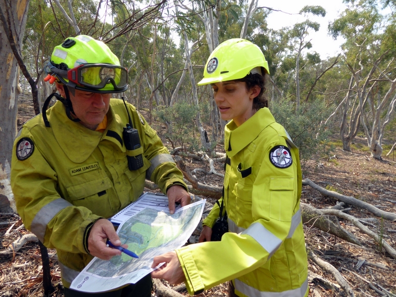
Adam Leavesley of ACT Parks & Conservation and Dr Marta Yebra, a member of the ANU’s Water and Landscape Dynamics group, plan hazard reduction burns near Googong Dam in March 2015 (photo courtesy of Geoff Carey, ANU). A recent case study in the ACT by the ANU group used TERN’s climate data, alongside a number of other dataset and spatial resources, to assess the feasibility of providing fuel, water and carbon estimates at an unprecedented high spatial resolution of 25 m.
eMAST, together with fellow NCRIS capability the National Computational Infrastructure (NCI), is providing data on the main climate variables such as temperature, precipitation, radiation and vapour pressure—essential for input into models that assess and predict ecosystem change across the Australian continent.
At a spatial resolution of approximately 1km (0.01°), eMAST’s‘ANUClimate’ datasets are modelled with repeatable, state-of-the-art methods and incorporate historical Bureau of Meteorology data, impacts of proximity to the coast on temperature, and have refined the impacts of topography on precipitation. eMAST has also created ‘bio-climate’ indices—data from primary climatic inputs that have biological significance—that provide the research community with ready made ‘bio-climatic’ surfaces. Importantly, all the eMAST analyses incorporate comprehensive error checking and quality assurance processes.
Researchers and policy makers across the nation are already using the data. In a recently launched collaboration between eMAST, the NSW Office of Environment and Heritage, and Macquarie University, the data are being used to help identify climate refugia—locations of isolated populationss of a once more widespread species—that will support species range shifts under a changing climate.
The project is assessing the potential for different species to shift their distribution to track moving climate zones by considering barriers to movements, current land use patterns, landscape connectivity and health, proximity to/connectivity with existing protected areas, and species-specific list history traits.
In addition to provision of climate and bio-climate data, via the high performance computing resources of Intersect’s server, eMAST is contributing a substantial amount of manpower to the project. eMAST Director Bradley Evans and Intersect’s eResearch Analyst and eMAST member Stuart Allen are guiding and facilitating the development of the required computing infrastructure to utilise various innovations such as future climate scenarios for New South Wales.
Simultaneously to eMAST’s efforts in climate refugia, previously established collaboration projects using eMAST data proceed at a rattling pace with important outcomes being already presented to the research community.
As part of a Bushfire and Natural Hazards Cooperative Research Centre project called ‘Mapping bushfire and impacts’, Prof. Albert van Dijk and his Water and Landscape Dynamics group at The Australian National University (ANU) have been developing a model to provide best possible estimates on forest fuel load (known as biomass to ecologists), fuel flammability and fire impacts on landscape values such as water resource generation, carbon storage and habitat.
Recently, a case study in the Australian Capital Territory (ACT) was concluded covering the period 2000 to 2010 to assess the feasibility of providing fuel, water and carbon estimates at an unprecedented high spatial resolution of 25 m. The team integrated Landsat satellite imagery with terrain information from TERN’s Soil and Landscape Grid of Australia and TERN eMAST’s 1km daily climate grids.
“TERN’s daily climate grids are an important component of our modelling framework,” says Albert. “The data are particularly useful due to their spatial resolution of 1km, where we previously had to make do with 5 km – that means 25 times the amount of detail. Fire managers operate at a fine spatial scale so it’s vital that any information we provide to them is at a similar scale.”
“Spatial accuracy is important but so too is temporal coverage,” adds Albert. “We need the most up-to-date information possible, so the fact that the TERN datasets are regularly updated is another key factor.”
Now that the model framework’s ability to model fuel, water and carbon has been demonstrated, Albert and his team are working with fire managers in several states to develop and trial practical applications for the model, such as fuel load and moisture mapping, fire spread modeling and even real-time fire risk forecasting at high resolution.
“It’s great that we were able to make the system work, but now the focus is to develop practical applications for the model that will be useful for fire managers around Australia and will have the potential to change the way fire hazard is forecast and managed,” says Albert. “The continued and unthreatened availability of high-quality data such as that produced by eMAST is absolutely critical to achieve that.”
The ongoing outcomes of this study will not only be of high interest for planners, land managers and emergency services in their assessments of fire hazard and impact, but are also crucial in building an important bridge between research, technology and industry solutions.

|
eMAST, together with fellow NCRIS capability the National Computational Infrastructure (NCI), is providing data on the main climate variables such as temperature, precipitation, radiation and vapour pressure—essential for input into models that assess and predict ecosystem change across the Australian continent. |
Published in TERN newsletter April 2015