
The mystery of the Murray-Darling’s vanishing flows
It might be the biggest whodunnit — or what-dunnit — in Australia. More than 2 trillion litres of water — enough to fill Sydney Harbour four and a half times — has gone missing from our largest and most precious river system — the Murray-Darling Basin. And it’s happened in what was already one of the driest periods the basin has seen.
According to an investigation by some of Australia’s top water scientists, shared exclusively with the ABC, 20 per cent of the water expected to flow down the rivers from 2012-2019 was simply not there. That’s despite almost $7 billion being spent to protect the health of the system’s rivers and ecosystems that rely on them.
Was it stolen? Was it lost? Has climate change made it go up in steam? Or was it simply never there in the first place?
There are clues scattered up and down the rivers but one simple message is clear in the scientists’ findings. For the first time, they provide evidence that the Murray-Darling Basin Plan — the most expensive environmental program in Australia’s history — is delivering much less water than was expected.
And the implications could be huge.
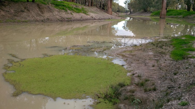
This enormous network of rivers, creeks, wetlands and valleys is what’s known as the Murray-Darling Basin.
To save the struggling river system, by 2019, federal and state governments had spent $6.7 billion, recovering 2.1 trillion litres of water to put back into the rivers.
Now, for the first time, researchers from the Wentworth Group of Concerned Scientists have modelled what the river system was expected to look like in 2019. The Wentworth Group, established in 2002, is a group of eminent Australian scientists concerned with conservation.
These circles represent what should have been flowing past 27 flow gauges, based on Murray-Darling Basin Authority modelling and weather data from that year.
But this is what 2019 looked like in reality. There was much less water than expected.
And every year since 2012, a similar pattern has been seen.
Sometimes sites in the river system see more water than expected, but most see less. Some much less. And year after year, the volumes of missing water add up.
The scientists say the model showing what should be expected can struggle to accurately simulate years where flows are extremely low and that it performs better over longer periods than it does for a single year.
So after seven years, a full 20 per cent of the expected water in the entire system was not there. That’s an average of 320 billion litres every year. And a total of more than 2 trillion litres of water.
“It’s a huge discrepancy to be missing a fifth of the water that’s meant to be in the rivers,” said Jamie Pittock from the ANU. He’s an expert in water management and a co-author of the Wentworth Group’s report.
“It means that there are all sorts of things that Australians value that won’t be sustained … like more water for towns … the floodplains, growing grass for sheep and cattle, in terms of biodiversity being conserved, waterbirds, red gum forests and conserving our fish.”
Rob Vertessy is a hydrologist and chair of the Murray-Darling Basin Authority’s (MDBA) Advisory Committee on Social Economic and Environmental Sciences.
He said the report was an important contribution to the body of scientific knowledge on the system.
“It is pointing to a problem, which I guess people have had a sense of, but which hasn’t been properly dimensioned until now,” Professor Vertessy said.
“The levels of flow in the river are lower than everyone would have hoped.”
The MDBA itself worked with the Wentworth Group to help with the analysis over the past several months, and is completing its own similar analysis set to be released later this year.
The MDBA’s head of basin strategy, Vicki Woodburn, said the shortfall was not a failure of the basin plan itself, since it was still being implemented.
The missing water is a mystery — nobody knows exactly why it’s not being seen in the rivers.
But here’s the thing: there are clues. Lots of them. We’ve seen water go missing up and down the river with clear explanations before. And looking closely at the new report, many of those explanations are consistent with the new data.
Clue one: tampered meters and criminal prosecutions
One possible explanation for the shortfall is that some of the missing water has been stolen.
An investigation by Four Corners in 2017 put water theft in the spotlight — much of it around the Barwon-Darling catchment in the Northern Basin.
But on top of those official figures, there has been significantly more water taken in that area. The Murray-Darling Basin Authority itself estimated that in the Northern Basin, as little as 25 per cent of surface water take has been metered.
Some of the water that went unmetered was stolen.
Peter Harris, who was named in the 2017 Four Corners, was this year found guilty of water theft just upstream from those gauges at Brewarrina.
Anthony Barlow, another person named in the program, was found guilty and fined $190,000, for water theft just upstream again.
Since the Natural Resources Access Regulator (NRAR) was formed in NSW in 2018, 15 additional charges have been laid in these locations across the state for water theft and related actions, according to an NRAR spokeswoman.
Emma Carmody, a lawyer at the Environmental Defenders’ Office, said the criminal prosecutions do not represent how widespread water theft has been.
“I’d actually go so far as to say that this situation pre-2018 was catastrophically bad in those northern catchments in relation to compliance and enforcement,” Dr Carmody said.
Irrigators deny water theft is a significant issue in the missing water mystery.
“I think if people are saying, ‘oh, well, this is about water theft’, then what they’re doing is really just trying to find someone to blame rather than trying to find solutions,” said Steve Whan, the CEO of the National Irrigators’ Council.
It’s probably impossible now to calculate the true scale of water theft over the seven years analysed by the Wentworth Group, but it’s unlikely to explain much of the shortfall. And whatever role it played, there are other key suspects in the case of the missing water.
Clue two: shadow take
Travel further upstream along the Macquarie River towards Dubbo, and you land in the internationally protected wetlands of the Macquarie Marshes.
It’s one of the largest remaining inland, semi-permanent wetlands in the Murray-Darling Basin and supports more than half a million birds in a large flood.
In the vast flat landscape, decent rains cause water to spill over the banks of the Macquarie and its tributaries and spread as far as the eye can see.
This water taken by irrigators and graziers from the floodplains — rather than from the rivers — has hardly ever been measured.
Using satellite imagery, flood paths appear guided by seemingly innocuous structures, or completely cut off by others.

Richard Kingsford is a river ecologist at the University of New South Wales who has studied the Macquarie Marshes and the impacts of floodplain harvesting.
He says water that spills over floodplains often drains back into rivers, and interrupting its flow can have big impacts, including contributing to the missing flows.
“There are very few places where we have an accurate estimate of how much water is being taken from the floodplain. And to me, this has been a yawning gap in the policy,” he said.
This floodplain harvesting was not always illegal — so long as the earthworks were approved and the total amounts taken were within certain limits. But without proper measurement, nobody can be sure, and the volumes taken were unknown.
The idea that floodplain harvesting could explain some of the missing water fits with the data in the Wentworth Group’s report. In late 2016, there was a flood in some parts of the basin and despite there being much more water in that period, the shortfall remained high.

“During the wet sequences, which haven’t been frequent … I think it’s a matter of legitimate disquiet that many have about the failure to really bring those floodplain harvesting schemes into the calculations,” says Professor Vertessy.
“It’s well past the time that we should have a full fix on that,” he said.
In NSW, where the potential for floodplain harvesting is the biggest, rules are now being implemented to measure it.
Steve Whan from the National Irrigators’ Council said the new rules would help reduce shortfalls in future analyses.
“We’re seeing extensive work done to improve measurement, including bringing floodplain harvesting into a volumetric system … And all those things are really important steps. Many of them are still only partway through,” Mr Whan said.
Clue Three: The cash splash
If we head all the way to southern NSW, we see a completely different clue.
Billions have been spent subsidising “efficiency measures” to help farmers save water there.
That can be done by upgrading old irrigation systems to deliver water directly to roots, or lining water channels, for example. Then about half of the water saved by the farmers gets handed to the government for the environment.
But according to some experts, the “inefficiencies” prior to the upgrades just meant some of the water used by irrigators flowed back into the rivers. The upgrades mean that “return flow” stops happening.
“So when you say ‘I’ve saved all this water’, the question is what was it doing before it was saved?” said John Williams, another co-author of the Wentworth Group report and former head of the CSIRO’s Division of Land and Water.
In a report published in 2019, Professor Williams estimated that at least 280 billion litres of water per year might have been lost from the rivers — and are unaccounted for — due to this problem.
“That must be a major reason that we’re not getting the flow regimes that we need,” Professor Williams said.
The MDBA commissioned its own analysis of the issue and concluded the loss of return flows was reducing water in the rivers by 121 billion litres a year.
They say that review shows the reduction in return flows is not a significant factor and does not impact the outcomes of the basin plan.
“The most comprehensive analysis suggests it is an issue, but not a huge one,” said Professor Vertessy.
Clue Four: Climate change
There is one issue, however, that most experts do agree is a major reason for the missing water in the basin.
“The MDBA considers a changing climate to be the primary contributory factor,” said the MDBA’s Vicki Woodburn.
Since the basin plan was introduced, heat records across the area have been broken in four of the eight years. The last three years have been the hottest ever recorded in the basin.

According to the South Australian royal commission into the Murray-Darling basin plan, the MDBA “completely ignored climate change” when determining how much water needed to be saved.
If true, that means the overall target may have been set too low — that more water needs to be recovered from irrigation to save the river system.
But the same models used to set those targets have also been used to manage the rivers, and now to calculate how much water should be in the rivers. And by inadequately accounting for climate change, those models are likely over-predicting how much water is being recovered.
Climate change means more water is likely being lost between gauges, as it flows along — lost into the dry river beds and the hot air.
“The river models that project where the water will be in the rivers haven’t accounted for things like greater evaporation of water,” said Professor Pittock.
Professor Vertessy said most people were surprised by the magnitude and speed of the changes seen across the basin.
“I think a very important thing to appreciate is that we’re in a very different hydro-climatic sequence than we ever would have envisaged at the time of the architecting of the basin plan,” he said.
Clue five: The water was never there
In a twist worthy of any whodunnit, could it be that some of the missing water was simply never there in the first place?
According to the Wentworth Group, the government modelling used to predict how much water we should see in the river has some fundamental flaws which likely exaggerate the volumes.
For example, in 2018, the Murray-Darling Basin Authority found its modelling “has trouble predicting low flows”.
That meant that when water stopped flowing in the river, the model would still show water flowing — something that could have been particularly problematic over the past seven years when low flows were very common.
If true, it likely means much more water needs to be recovered to save the system to get the same outcomes.
The Wentworth Group scientists say they are confident they applied the modelling as best as was possible, and Rob Vertessy, who advises the MDBA on science, agrees.
“Given their intent, which is to make a comparison of expected flows and those which were realised, then, yes, I think it’s as solid as any approach you could adopt,” he said.
But the MDBA has some reservations. “While the Wentworth Group has partially accounted for the climate and as-yet-unfinished basin plan implementation, both effects are still present in the analysis and inflate the outcome,” said Vicki Woodburn.
Everyone seems to be on the same page about how much better the modelling needs to be.
“The MDBA is working to achieve this improved modelling, however it requires further investment and would be done in collaboration with all basin governments,” said Ms Woodburn.
“This type of analysis should be a fairly routine thing, but in effect, it’s a significant research project,” said Professor Vertessy.
But Wentworth Group scientists are scathing of the lack of adequate modelling and monitoring of flows.
“You can’t manage properly what you’re not measuring. And it’s concerning that the governments haven’t been measuring the … real water in the rivers against their flow targets,” said Professor Pittock.
What it all means
If there’s less water in the rivers than we ever planned for, what’s to be done about it?
Irrigators say the response should not be to buy more water from farmers, as that would cost too many jobs.
“If we think about changes to [sustainable diversion limits], then we also have to then think about what impact it has on those things as well,” said Steve Whan from the National Irrigators’ Council.
Mr Whan wants environmental targets to focus more on “complementary measures” — measures of environmental health, rather than volumes of water.
The MDBA itself says we need to wait until more of the basin plan is enacted before we think about changing the recovery targets, or “sustainable diversion limits” (SDLs) — which are set for review in 2026.
“The basin plan is still not fully implemented so it is too early to suggest the SDLs need to change,” says Vicki Woodburn.
But Professor Vertessy, who advises the MDBA, thinks this sort of shortfall could contribute to a rethink of the long-term water recovery targets.
“We may have to — I think everyone would accept that these sustainable diversion limits aren’t quantities which you ossify for posterity,” he says.
“They’ve got to be adjusted to fit in with the new climate realities and the social preferences of the day.”
And the scientists say whatever the response to the findings, something has to give.
“The current basin plan tries to pretend that we can do everything with a smaller and smaller cake,” says Professor Pittock.
“What this really means is that society is going to have to make some hard choices. How much irrigated agriculture do we want as a society versus how much do we want to retain by way of wetlands and ecosystems [or] of sites of cultural value to Indigenous people?”
Originally published by ABC News, 3 September 2020 (link)