enGauge summarises news from Climate, Water and Environmental programs of the Bureau of Meteorology. In the December 2013 issue:
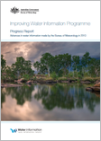
- Improving Water Information Programme Progress Report 2013
- Guide to environmental accounting in Australia
- Drought conditions return to Australia’s eastern states
- What’s the state of the climate?
- Welcome to the Cloud Nasara
- Monitoring Great Barrier Reef ocean temperatures
- Geofabric web services
- Season’s greetings from the Bureau of Meteorology
| |
 |
|
|
| |
December 2013 |
 |
| |
| |
| |
| |
Improving Water Information Programme Progress Report 2013
|
|
| |
 The Bureau’s expanding suite of national water information products and services is enabling more informed decision-making for water resource management in Australia. The Bureau’s expanding suite of national water information products and services is enabling more informed decision-making for water resource management in Australia.
The 2013 Progress Report describes the Bureau’s progress in implementing the ten-year Improving Water Information Programme, which began in 2007. |
|
| |
|
|
| |
|
| |
| |
| |
| |
Guide to environmental accounting in Australia
|
|
| |
 The new Guide to environmental accounting in Australia aims to improve environmental outcomes and contribute to the country’s long-term sustainability. The new Guide to environmental accounting in Australia aims to improve environmental outcomes and contribute to the country’s long-term sustainability.
The Guide will help policy makers, scientists and accounting practitioners decide whether environmental accounts will be beneficial, and, if so, show them how to create them. |
|
| |
|
|
| |
|
| |
| |
| |
| |
Drought conditions return to Australia’s eastern states
|
|
| |
 Drought has returned to areas of inland eastern Australia despite average to above average rainfall across much of the continent during 2013. Drought has returned to areas of inland eastern Australia despite average to above average rainfall across much of the continent during 2013. |
|
| |
|
|
| |
|
| |
| |
| |
| |
What’s the state of the climate?
|
|
| |
 Do you want to know how Australia’s climate has been tracking in recent years? Are you interested in significant or record-breaking weather events and how recent conditions compare to longer-term trends? Do you want to know how Australia’s climate has been tracking in recent years? Are you interested in significant or record-breaking weather events and how recent conditions compare to longer-term trends? |
|
| |
|
|
| |
|
| |
| |
| |
| |
Welcome to the Cloud Nasara
|
|
| |
 Welcome to the Cloud Nasara is a new animated short film that raises awareness of the science and impacts of El Niño and La Niña in Vanuatu. Welcome to the Cloud Nasara is a new animated short film that raises awareness of the science and impacts of El Niño and La Niña in Vanuatu. |
|
| |
|
|
| |
|
| |
| |
| |
| |
Monitoring Great Barrier Reef ocean temperatures
|
|
| |
 ReefTemp Next Generation is a new high resolution mapping tool that gives a daily snapshot of water temperature across the entire Great Barrier Reef. It will be used by climate scientists, from organisations such as the Great Barrier Reef Marine Park Authority, to monitor the Reef over the coming summer. ReefTemp Next Generation is a new high resolution mapping tool that gives a daily snapshot of water temperature across the entire Great Barrier Reef. It will be used by climate scientists, from organisations such as the Great Barrier Reef Marine Park Authority, to monitor the Reef over the coming summer. |
|
| |
|
|
| |
|
| |
| |
| |
| |
Geofabric web services
|
|
| |
 Geofabric users can now utilise a range of proprietary and non-proprietary GIS software, including Google Earth, or their preferred programming language toaccess Geofabric data via a web application programming interface. Geofabric users can now utilise a range of proprietary and non-proprietary GIS software, including Google Earth, or their preferred programming language toaccess Geofabric data via a web application programming interface.
The Geofabric registers spatial relationships between important hydrological features such as rivers, water bodies, aquifers and monitoring points. |
|
| |
|
|
| |
|
| |
| |
|
|
|


 The Bureau’s expanding suite of national water information products and services is enabling more informed decision-making for water resource management in Australia.
 The new
  Drought has returned to areas of inland eastern Australia despite average to above average rainfall across much of the continent during 2013.
 Do you want to know how Australia’s climate has been tracking in recent years? Are you interested in significant or record-breaking weather events and how recent conditions compare to longer-term trends?

 Geofabric users can now utilise a range of proprietary and non-proprietary GIS software, including Google Earth, or their preferred programming language to