
Improving irrigation water use accounting using satellite data
Surface irrigation water demand in the northern Murray-Darling Basin can be better accounted when using remotely-sensed irrigation extent and rates of actual evapotranspiration in hydrologic modelling, both in terms of magnitude and temporal patterns.
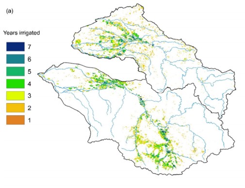
In their recent study of irrigated agriculture accounting, Dr Jorge Peña-Arancibiaa (CSIRO) and colleagues investigated the usefulness of remotely-sensed changes in irrigation extent and rates of actual evapotranspiration in hydrologic modelling, in order to quantify irrigation water use and water provenance (either surface water or groundwater).
“Globally, irrigation accounts for more than two thirds of freshwater demand,” says Dr Peña-Arancibia. “However, the spatial extent, year-to-year dynamics and water use of many important irrigated areas remains a source of major uncertainty in water use assessments.”
The authors of the study suggest that their approach can also be implemented in other areas where irrigation dynamics are poorly understood, to pinpoint areas that require better monitoring and to constrain irrigation models in data scarce regions.
Peña-Arancibiaa, J., Mainuddin, M., Kirby, J., Chiew, F., McVicar, T. and Vaze, J. 2015, Assessing irrigated agriculture surface and groundwater consumption by combining satellite remote sensing and hydrologic modelling, Science of The Total Environment, Volume 542, Pages 372–382. doi:10.1016/j.scitotenv.2015.10.086