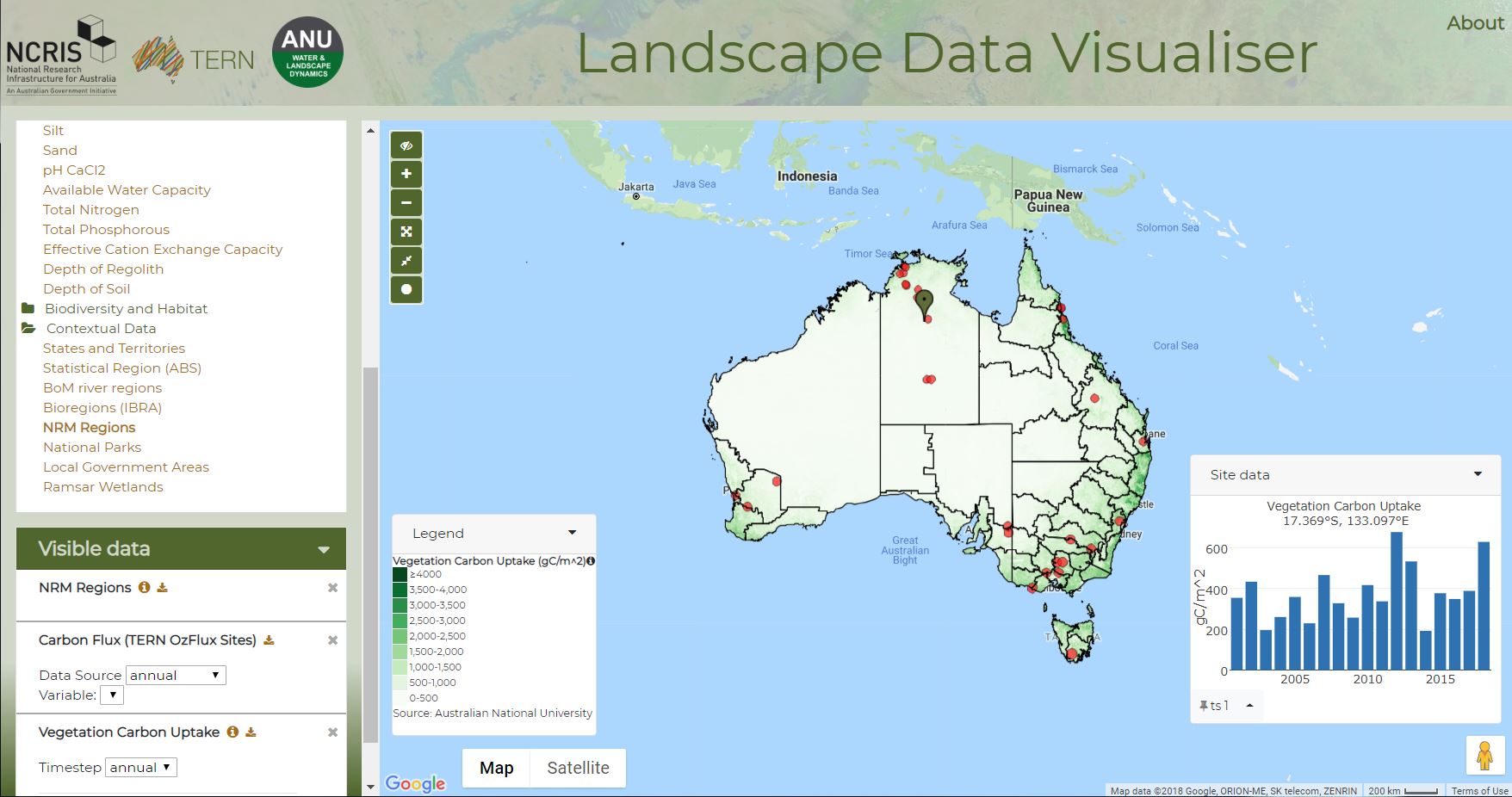
TERN-ANU Landscape Data Visualiser: discovering an entire ecosystem of data

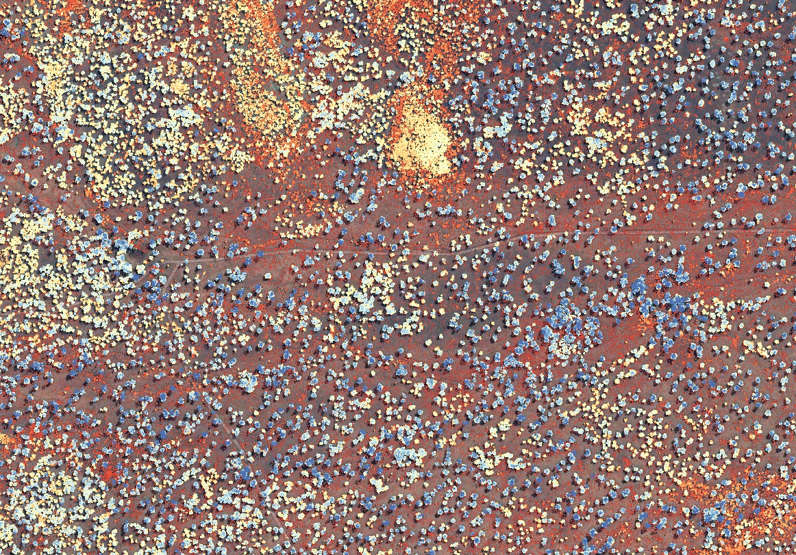
The height of individual tree crowns near Alice Springs derived from TERN’s airborne lidar collection.
The sheer abundance of data on Australia’s natural environment means that the data cannot be easily explored and analysed by non-expert users.
To solve this, the ANU Centre for Water and Landscape Dynamics (ANU-WALD) and the Terrestrial Ecosystem Research Network (TERN) have teamed up to create the TERN-ANU Landscape Data Visualiser.
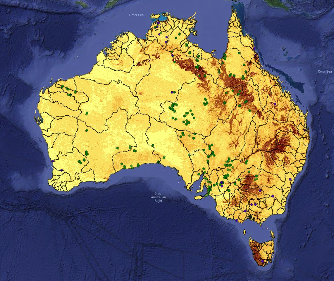 The web atlas lets you discover a wealth of landscape and ecosystem data from satellite observations, airborne measurements, field surveys, sensor networks and national-scale model predictions.
The Landscape Data Visualiser gives you access to over 50 data sets, providing information on:
- River flows and inundation
- Soil moisture
- Soil depth, texture and chemistry
- Water and energy exchanges
- Bushfires
- Carbon uptake and release
- Ecosystem composition
- Vegetation properties
You can you drill down to any location of interest, compare data and locations, and download any of the data shown. More information on the data sources and how to use the site can be found here.To start your discovery, you can access the Landscape Data Visualiser via TERN (maps.tern.org.au) or via ANU (anuwald.science/ternanu), or click below.