
A new look at Australia’s water features

It’s now easier to see how water might flow through the landscape without needing specialised software. Visualising connections between water sources and other environmental features has been made simpler, with improved web services integrating National Environmental Information Infrastructure data services with the Australian Hydrological Geospatial Fabric (Geofabric).
You can also delve into the data behind the models, with catchment data tables and network stream connectivity tables showing upstream and downstream relationships.
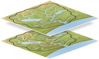
The Geofabric is a digital database of surface and ground water features—like a street directory of Australia’s important hydrologic features—while the National Environmental Information Infrastructure improves the discovery, access and re-use of nationally significant environmental data.
Find out more about the Geofabric and the National Environmental Information Infrastructure, or access these data services through the Geofabric website, or the NEII Viewer or Catalogue.
Original article available in enGauge (Bureau of Meteorology), August 2016 (Link)