• Featured
  • About us
  • Themes
  • Events

Tag: AWRA

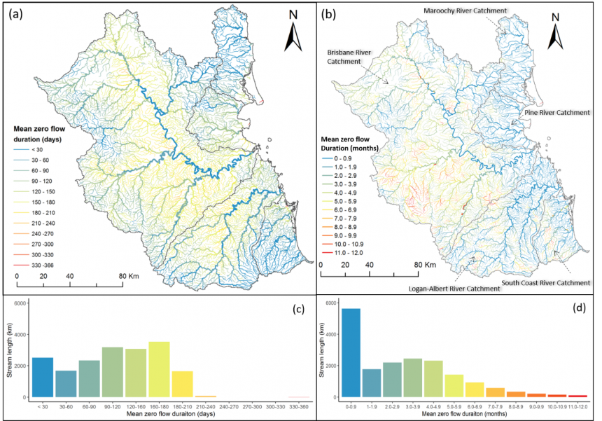
Evaluating a daily water balance model (AWRA-L) to represent streamflow intermittency
January 31, 2021 Songyan Yu and Mark Kennard (Griffith University)

There is a growing interest globally in the spatial distribution and temporal dynamics of intermittently flowing streams and rivers. Previous studies have predominantly relied on the use of gauged streamflow data to make inferences about the distribution of […]

Read more
  • Publication

A sharp, global picture of irrigation and wetland evaporation losses

January 28, 2018 Albert van Dijk (ANU)

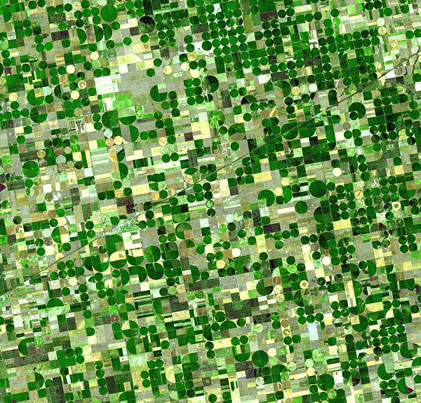
New study uses detailed satellite observations to estimate evaporation from irrigation, water bodies and wetlands worldwide. A good part of our global surface and groundwater resources evaporates from wetlands, water bodies and irrigated areas. Some of this so-called ‘secondary’ […]

Read more
  • Uncategorized

AWRA-L Community Modelling System released, hands-on training available

November 11, 2016 Amgad Elmahdi (Bureau of Meteorology) Leave a comment

The Australian Water Resource Assessment Landscape (AWRA-L) Model is a 0.05° (approximately 5 km) gridded daily water balance model developed by CSIRO and the Bureau of Meteorology for Water Resource assessment purposes (see Hafeez et al., 2015; Viney et […]

Read more
  • Uncategorized

Assessing our water resources

December 21, 2015 source: enGauge (Bureau of Meteorology) Leave a comment

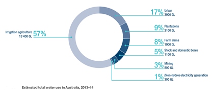
With many pressures on water resources around Australia, it’s important to take stock and assess water availability and use across the country. Water in Australia 2013–14 is our first assessment report to provide a national overview of climatic […]

Read more
  • Articles
  • Data sets

Balancing water across the Australian landscape

December 21, 2015 source: enGauge (Bureau of Meteorology) Leave a comment

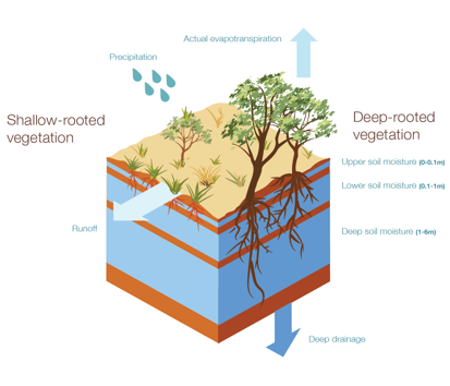
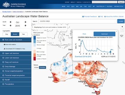
The landscape water balance is the sum of the hydrological processes that keep water moving through a landscape—recharging groundwater, filling streams and flushing water through wetlands. This water balance also determines how much moisture is in the soil—a […]

Read more
  • Articles
  • Data sets
  • Theme: Model Evaluation and Benchmarking
  • Theme: Trends and Extremes

Declining rainfall in parts of Australia, but still plenty of water available: BOM report

December 21, 2015 Malcolm Watson (Bureau of Meteorology) Leave a comment

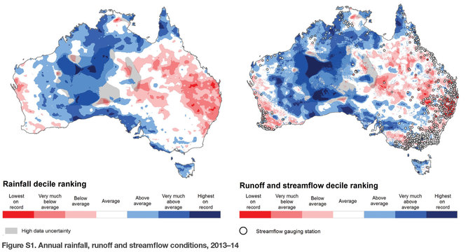
The Millennium Drought ended more than five years ago, but several years of below-average rainfall and El Niño have brought drought back to many parts of Australia. Our latest report on water in Australia shows rainfall is continuing […]

Read more
  • Articles
  • Theme: Trends and Extremes
gewex_lighter   Hepex_build_lighter

Quick Links

  • Apply for the 2020 Summer Institute
  • OzEWEX 2019 proceedings
  • OzEWEX 2017 proceedings
  • OzEWEX 2016 proceedings
  • OzEWEX 2015 proceedings
  • OzEWEX 2014 proceedings
  • 2017 Summer Institute
  • 2016 Summer Institute
  • What is OzEWEX?
  • Contact us

On social media

Unable to load Tweets

Follow

Upcoming Events

There are no upcoming events at this time.

Most Read

  • New global 1 km resolution Köppen-Geiger climate…
  • Call for Applications 2018/19 Australian Climate and…
  • Semi-arid ecosystems particularly sensitive to mega-droughts
  • 9000-year Murray River flood record discovered
  • The 2020 Australian Climate and Water Summer Institute
  • AWRA-L Community Modelling System released, hands-on…
  • Seven things you didn’t know about farm dams
  • 4th OzEWEX workshop, 6 December 2017, Hobart
  • What is OzEWEX?
  • Water consumption rises as south-east Queensland dam…

Supported by

australiangov CSIRO_Logo.svg GA_Logo.jpg TERN_Logo.jpg anu BNHCRC_Logo.jpg NCI_Logo.jpg

Powered by WordPress and Dynamic News.